About Maryland CMS Map
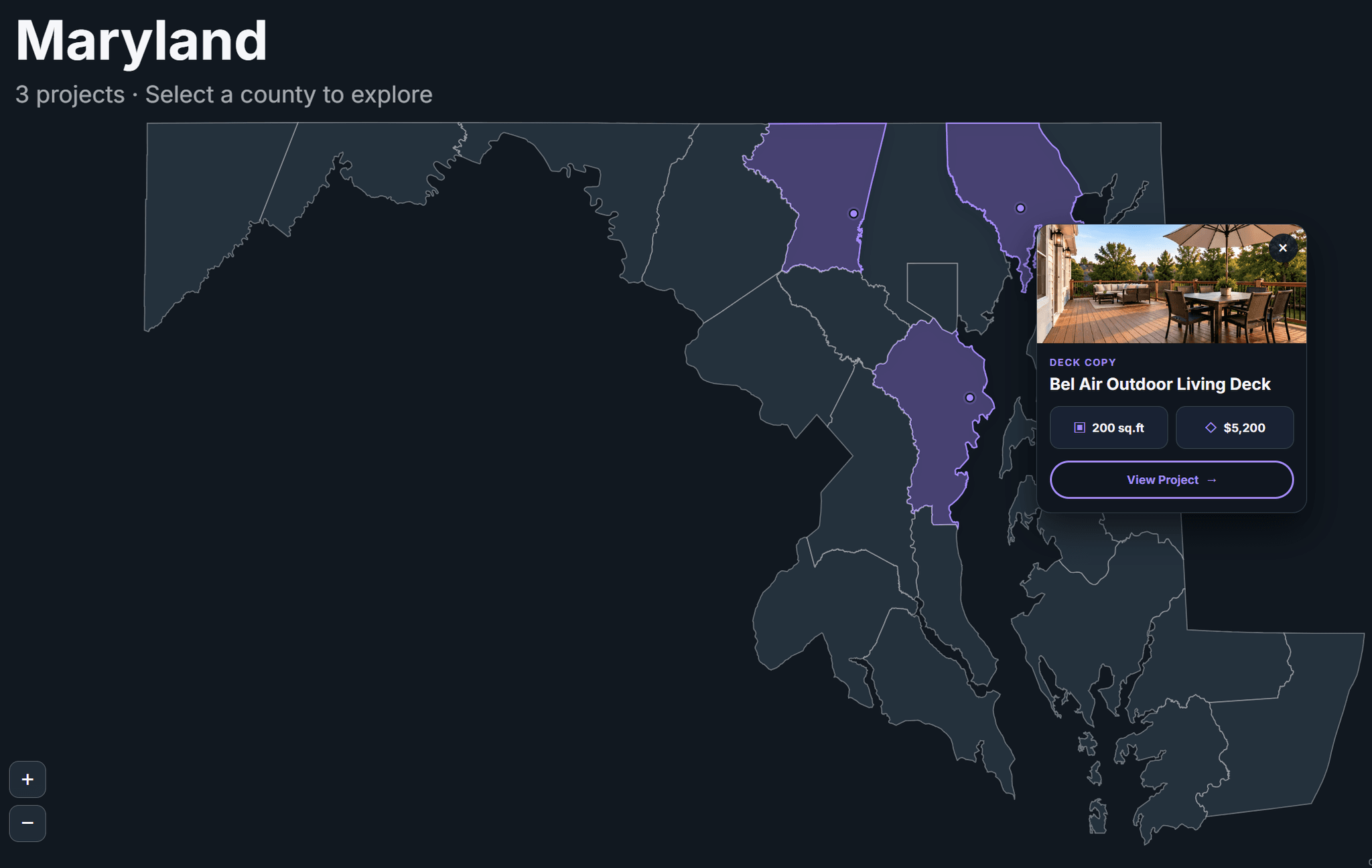
Maryland Project Map is an interactive, CMS-powered map designed to showcase construction projects, real estate listings, and completed work across Maryland.
Display projects directly on an interactive Maryland map with location markers, county boundaries, and detailed project cards. Visitors can explore counties, zoom into specific areas, preview project details, and open individual project pages.
Powered by Framer CMS, the map automatically displays your projects using information from your CMS collection. Simply add or update a project, and the map reflects the changes without manually placing markers or editing code.
Key Features
Native Framer CMS integration with automatic project updates
CMS-connected project names, types, sizes, prices, images, and links
Interactive Maryland map with clickable county boundaries
Smooth county zoom and 3D-style hover effects
Automatic project markers using street names and cities
Interactive project cards with photos and details
Direct links to individual CMS project pages
Optional project prices with show/hide controls
Mouse dragging and zoom-in/zoom-out buttons
Customizable default zoom and starting position
Adjustable colors, borders, typography, and button text
Approximate locations for customer privacy
No Mapbox API key or manual GPS coordinates required
Illustrated PDF installation guide included
Where to Use
Construction Company Websites
General Contractor Portfolios
Home Remodeling Websites
Deck and Patio Construction Companies
Fence Installation Companies
Roofing Contractor Websites
Real Estate Agencies
Property Investment Websites
Local Service Business Portfolios
Completed Project Showcases
Landscaping and Hardscaping Businesses
Home Renovation Portfolios
Architecture and Design Studios
Real Estate Websites
Property Listing Platforms
Maryland-Based Business Websites